In recent years, the trail system on Rattlesnake Mountain has been revamped. There is now a groomed trail, without logging roads, that runs from Snoqualmie Point on the west side of the mountain all the way to Rattlesnake Lake. The trail is 11 miles long, with an elevation gain of about 2200 feet from either end.
My wife and I undertook this hike yesterday, our most aggressive to date. For the first time on our hikes we left the kids behind, as this is too aggressive for young kids (we did see a teenager running up Rattlesnake Ledge TWICE... wow, to be young and in shape again).
The trail wanders through different terrain; first on grass and trees, then through thick forest, then opens up to an area that's been logged, then through thick, shoulder-high brush, back through an open area, then through tall evergreens, then through brush again, then through a nice dirt path, and finally through rocks. It is quite varied and the change of scenery every mile or so is refreshing.
We started this trip from Snoqualmie Point (which in and of itself is fun, with a great view of Snoqualmie Valley, hence the name). At about two miles you get to the first great viewpoint. Another three miles will get you to "Grand Prospect", which lies directly north of North Bend (it's the peak you see as you drive north to the I-90 interchange). The next two miles will take you up and down between Grand Prospect and East Peak. The East Peak has some great views as well, peeking behind Mount Teneriffe. The East Peak is the highest point on this trail, at 3250 feet. From there, it's downhill. A mile and a half from the peak you will get to the first of three "Rattlesnake Ledges." The other two are a quarter mile away each. The last two miles is a long walk down from Rattlesnake Ledge to Rattlesnake Lake. This last stretch is the most popular stretch - most people hike/run this stretch only. On this day (a beautiful Sunday) we only met two people that were hiking the entire trail.
The views are simply magnificent. We chose a perfect day, and could see deep into the Cascades in every direction.

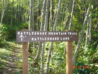
Whew... just 11 miles to go!

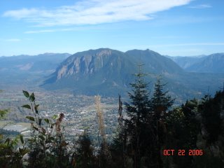
The twin peaks view... Mount Si (left), Mount Teneriffe, and North Bend from Grand Prospect.

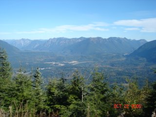
Snoqualmie Valley due north... you can can barely see Mount Teneriffe on the left... from a side trail off east peak (some say this is the best view from Rattlesnake Mountain).

The lowest RattleSnake Ledge as seen from the "second ledge." (Look for the people at the bottom of the picture)